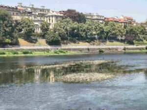
Nearly one-fifth of Italy’s coastline is now affected by hard defense works, structures built to counter erosion and storm surges but increasingly the focus of technical and environmental debate. The new geodatabase published by Ispra makes it possible for the first time to have a complete and updated mapping of these interventions along the national coastline-a useful tool for coastal risk planning and management.
Stronger swells
Already in 2020, more than 1,500 kilometers of coastline-about 18 percent of the total-were altered by the presence of reefs, groins and seawalls, a 27 percent growth since 2000. In some regions the expansion was even more pronounced: Calabria, for example, recorded a 66 percent increase in affected coastal stretches. In recent years the trend does not seem to have stopped and, following the recent trend, dozens more kilometers of artificialized coastline are estimated.
The increase in these structures is closely linked to increasing climate pressure.Rising sea levels, increased intensity of storm surges and more frequent Mediterranean cyclones are accelerating erosion phenomena, making many coastal areas increasingly vulnerable. In this context, hard works are presented as the most immediate solution to protect infrastructure, housing and tourist establishments.
But these artificial structures, especially when designed without a systemic vision, can alter the natural dynamics of sediments along the coast, preventing the transport of sand and gravel and changing the morphological balances of shorelines. In some cases, protection of one coastal stretch can result in increased erosion in nearby areas, with cumulative effects that over time require new interventions, generating a progressive artificialization of the coastal landscape.
It came to 11 thousand rigid defense works
In recent decades about 11,000 rigid defense works have been built along the Italian coasts, with different solutions depending on territorial characteristics. In Liguria, groynes perpendicular to the shore, which retain sediment, prevail; along the Adriatic, reefs detached from the coastline to attenuate wave energy are common; while in some Tyrrhenian areas more complex systems, such as “T” groynes, are found.
It is precisely the increasing spread of these infrastructures that has made a more detailed cognitive tool necessary. The new Ispra geodatabase integrates and updates the information already available on national coastal planning, making it possible to precisely identify the stretches affected and the characteristics of the works present. The goal is to improve the planning of future interventions, favoring more integrated solutions that combine artificial defenses, beach nourishment and interventions based on natural approaches.
The challenge in the coming years will be to strike a balance between protecting coastal communities and safeguarding ecosystems. Rigid works will continue to play an important role in specific contexts, especially in urbanized or high-exposure areas, but more and more studies are pointing to the need to pair them with more flexible and less impactful adaptation strategies, capable of working alongside natural processes rather than replacing them. The new database is a step in precisely this direction: knowing more about where and how action has been taken is a prerequisite for designing more effective and sustainable long-term coastal defenses.