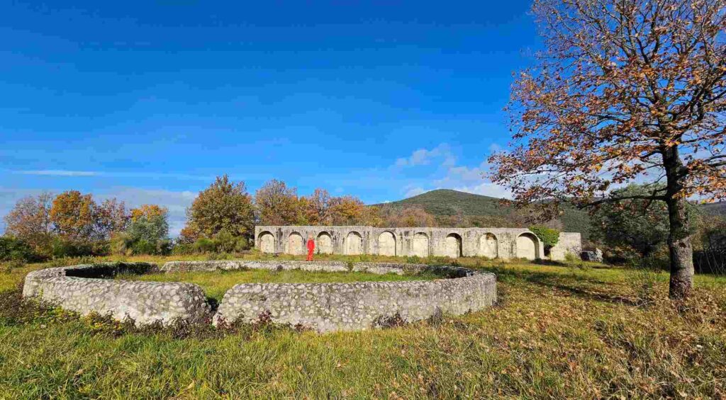
Beneath the hills of Sabina, where the landscape alternates between olive trees and tufa rocks, archaeology has unearthed an ancient Roman aqueduct. The discovery occurred in Montopoli di Sabina, in the province of Rieti, and is linked to the Villa dei Casoni, a residential complex from the Republican era that fed questions about its water supply network for more than two centuries.
For generations, scholars and enthusiasts had speculated about the presence of underground canalizations. Historical sources spoke generically of “very ancient aqueducts” and of an evocative spring, the so-called Varro Spring. What was missing, however, was concrete evidence, a survey capable of transforming suggestions and tales into verifiable archaeological data. Today that gap is filled thanks to investigations coordinated by the Soprintendenza Archeologia Belle Arti e Paesaggio and the contribution of the Gruppo Speleo Archeologico Vespertilio.
A refined mechanism
Explorations revealed an intricate system of tunnels dug into the natural conglomerate, about 300 meters from the villa. Not simple passages, but a true hydraulic infrastructure designed to capture and drain water from multiple springs. The water was conveyed to a cistern where sediment would settle before distribution to the residential rooms. A refined mechanism that ensured continuity and quality of the resource, feeding baths, nymphaea, fountains and gardens.
The technical fact is as striking as the historical one. The construction typology and some engineering solutions suggest that the first core of the system may predate the full Romanization of the area. The hypothesis is that an older hydraulic structure, perhaps related to a Sabine settlement, was later integrated and expanded with the construction of the Roman villa. If confirmed, this reading would draw a continuity of land use across different cultures, showing how Rome often absorbed and perfected local skills.
An ideal laboratory
The Villa dei Casoni thus emerges as an ideal laboratory for understanding the relationship between elites, technology and landscape in central Italy. On the complex’s sloping terraces, water was not only a practical necessity: it was comfort, aesthetics, a representation of power. It was a constant flow that transformed domestic space into scenography, among water games, thermal environments and ornamental architecture.
Crucial in this phase of the study is the use of noninvasive technologies. LiDAR surveys make it possible to map underground tunnels and structures with millimeter accuracy, returning a three-dimensional view of the entire system without resorting to extensive excavation. An approach that protects context and accelerates scientific understanding, connecting what is invisible underground with what remains visible above ground.
The significance of the discovery goes beyond the fascination of the find. It tells of sophisticated water management, engineering skills that dialogued with geology, and a material culture in which infrastructure and landscape were part of the same project. In times marked by droughts, water crises, and climate adaptation, these ancient tunnels remind us that water has always been a matter of spatial intelligence.