There is a coastal Italy measured in meters of elevation gain. It is the peninsula of limestone cliffs, smugglers’ trails, mule tracks carved through vertical vineyards, and ancient transhumance routes overlooking the Adriatic and the Tyrrhenian Seas. Walking these trails means understanding something fundamental about Italian geography: here, the mountains are almost never separated from the sea. They plunge right into it. From north to south, through areas long overlooked by tourism, ten trails offer a different perspective on the coastal landscape—and something well worth adding to any itinerary from spring through summer and into fall.
Rilke Trail, Friuli-Venezia Giulia
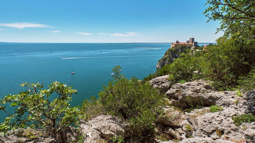
The journey begins in Friuli. The Rilke Trail stretches just over 2 kilometers between Sistiana and Duino, within a nature reserve that protects the cliffs of the Trieste Karst. The white limestone that plunges into the blue waters of the Gulf of Trieste offers a perfect geological cross-section of Italian karst formations. The trail, suitable for everyone, is flat, protected by fences, and follows in the footsteps of the poet Rainer Maria Rilke, who, in the early 20th century while staying at Duino Castle, found inspiration here for his *Duino Elegies*.About 3–4 km away lie the Timavo Springs, the point where the mysterious underground river resurfaces after traveling dozens of kilometers beneath the earth’s surface.
Length: ~2 km (Rilke Trail only) / ~6 km (extended route from Risorgive). Difficulty: Easy
Colle dell’Orso, Molise
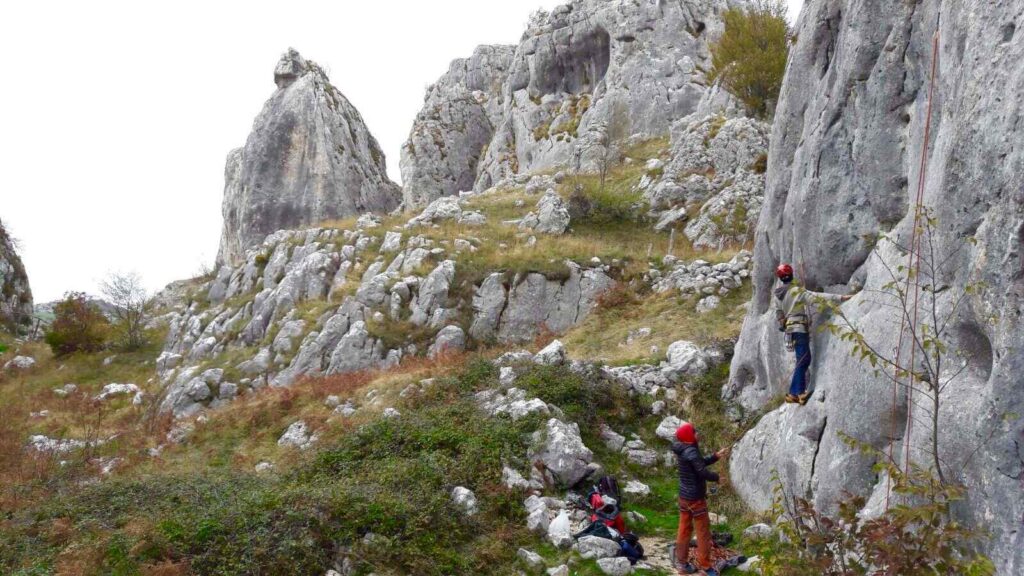
One of the most unusual vantage points on the peninsula. The Colle dell’Orso loop trail winds through the Frosolone area, in the province of Isernia, amid beech forests and limestone cliffs used for sport climbing, reaching an elevation of 1,393 meters. It is not a coastal trail in the strict sense, but on clear days the view sweeps across the Campobasso plain and extends clearly all the way to the coast of Termoli, the Tremiti Islands, and the silhouette of the Gargano. An Apennine balcony overlooking the Adriatic.
Length: Variable loop route (main route approximately 7–8 km). Difficulty: Moderate
Path of Infinity, Liguria
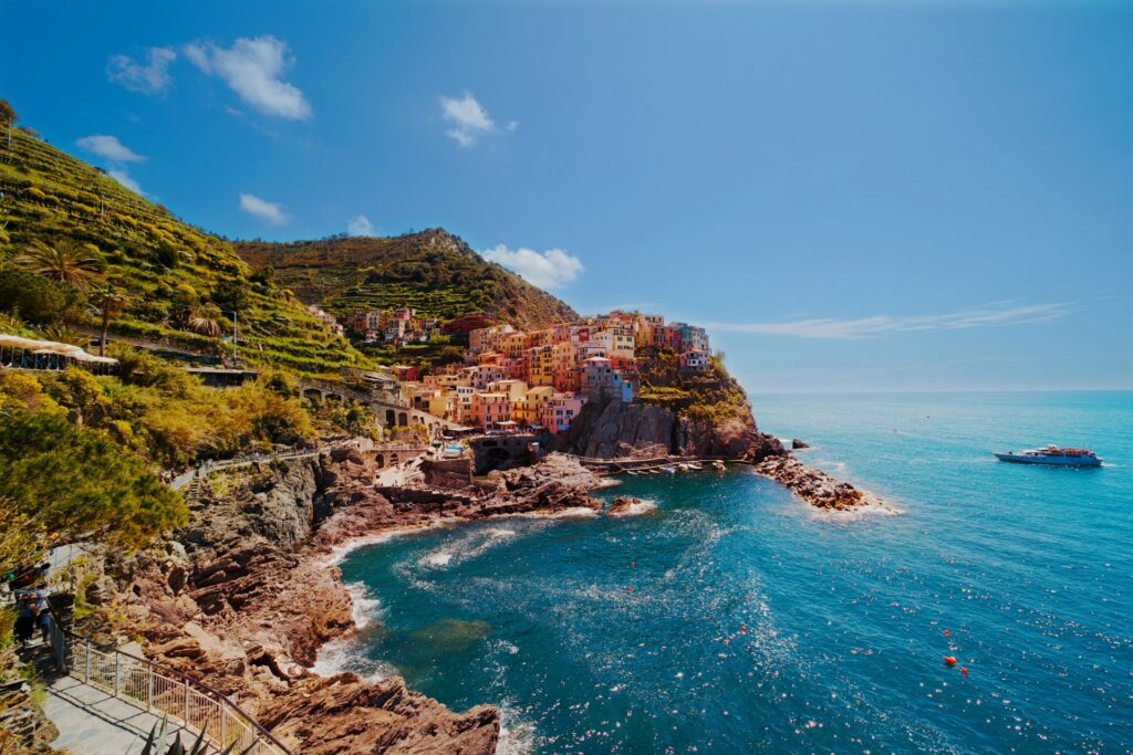
The much less-traveled alternative to the Cinque Terre Blue Trail. Thirteen kilometers from Riomaggiore to Portovenere via Campiglia, along the coast of Tramonti with its historic dry-stone terraces protected by UNESCO. The most challenging part is the detour to Monesteroli: a sandstone staircase descending toward the sea, consisting of about a thousand steps. It requires a sure footing and a head for heights.
Length: 13 km. Difficulty: Challenging (steep elevation changes and steep steps)
Path of the Gods, Campania
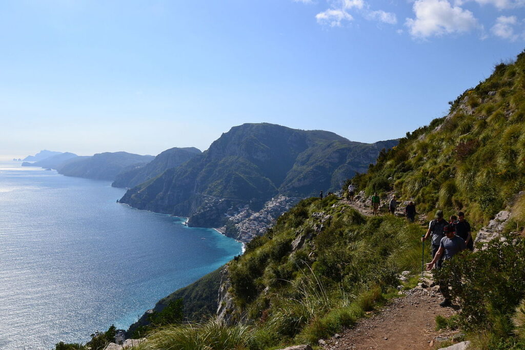
It’s nearly 8 kilometers from Bomerano (a hamlet of Agerola) to Nocelle, above Positano, along a path of mixed dirt and limestone that runs alongside imposing cliffs. In the past, this road was the only link between the coastal towns and the villages hidden behind the mountains. There were no cars or paved roads, and goods were transported only on foot or by mule. Today, it offers a spectacular, almost sheer view from above of the Amalfi Coast, the island of Capri, and its Faraglioni rocks. It’s very crowded in the summer: the secret is to set out at dawn.
Length: nearly 8 km (from Bomerano to Nocelle). Difficulty: Moderate
Mount Conero, Marche
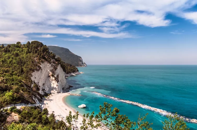
At 572 meters, Monte Conero is the only significant rocky promontory between Trieste and the Gargano. The loop trail starts at Passo del Conero, winds through dense Mediterranean scrub, and descends toward the stunning bay of Portonovo. Along the way, you’ll come across the brackish lakes Profondo and Grande and the Romanesque church of Santa Maria di Portonovo (11th century), lapped by the waves. From the top, you can enjoy a unique view of the white cliffs of the Due Sorelle.
Length: approximately 7 km loop. Difficulty: Moderate (with steep slopes on the descent toward the sea)
Trail of the Forts, Basilicata
Basilicata overlooks the Tyrrhenian Sea along just 32 kilometers of extraordinary beauty. The Sentiero dei Forti winds from Marina di Maratea to Castrocucco along a high coastline, connecting the ancient viceregal watchtowers and the ruins of the medieval castle. Five kilometers run parallel to dark gray limestone cliffs that plunge into the Gulf of Policastro, along a stretch of coastline that remains unspoiled and wild.
Length: 5 km. Difficulty: Easy / Moderate
Via del Ponente (Elba Island), Tuscany
In the western part of Elba, dominated by the granite massif of Monte Capanne, the Via del Ponente stretches for 16 kilometers, remaining consistently between 400 and 600 meters in elevation. You’ll walk on large sections of exposed granite paving, through old terraced vineyards and past the “caprili,” the ancient stone structures built by Elban shepherds. On clear days, you can see Corsica, Capraia, Pianosa, and Montecristo with the naked eye.
Length: 16 km. Difficulty: Moderate (due to the length and exposure to the sun)
Capo Trail, Puglia
The final segment of the Cammino del Salento and the region’s ideal geographical endpoint. The most spectacular stretch runs for 15 kilometers between the Canalone del Ciolo and Santa Maria di Leuca, hugging the cliffs of the Otranto-Leuca Natural Park. The Sentiero delle Cipolliane also winds its way from Ciolo, taking its name from the adjacent caves rich in Paleolithic artifacts. The trail ends at the monumental Leuca Lighthouse, where the geography marks the ideal convergence of the Adriatic and Ionian Seas.
Length: 15 km. Difficulty: Moderate
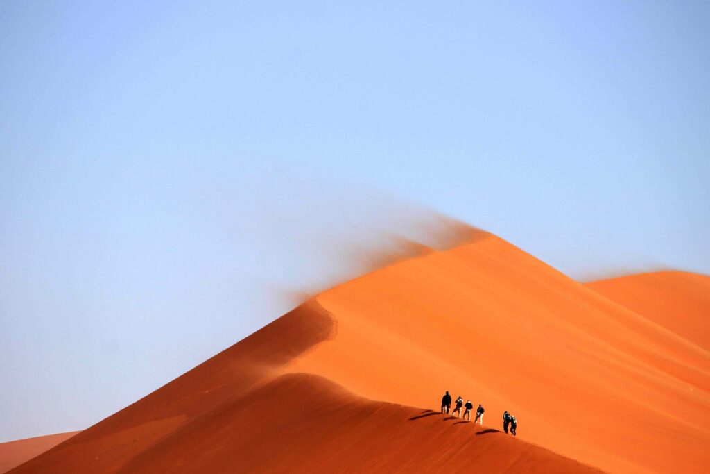
Selvaggio Blu, Sardinia
It is considered the most technical and challenging coastal trail in Europe. Conceived in 1987 by two Italian mountaineers, it stretches for about forty kilometers along the rugged limestone cliffs of the Supramonte di Baunei, in the Gulf of Orosei. This is not a hike for everyone: it requires excellent navigation skills in the absence of marked trails, as well as climbing sections and rappelling to reach the pristine beaches below, such as Cala Goloritzé. You’ll walk along the old trails of the charcoal burners, suspended over natural rock arches high above the abyss.
Length: ~40 km total (usually divided into 4 or 5 stages). Difficulty: Very difficult / Mountaineering
Sciara del Fuoco, Stromboli (Sicily)
The trail starts in the village of San Vincenzo and climbs toward the panoramic terrace at Punta Labronzo, winding through a lunar landscape of black sand and solidified lava flows. The maximum altitude to which visitors are permitted to climb is not fixed: it varies depending on alert levels and crater activity. From this natural balcony, you can overlook the Sciara del Fuoco, a steep natural ravine where debris ejected by explosions has slid directly toward the sea. The visual contrast is unique: the black of the basalt rock, the green of the Mediterranean scrub, and the cobalt blue of the deep Tyrrhenian Sea.
Length: ~5–6 km (round trip). Difficulty: Moderate / Challenging (sandy terrain and inclines).