A new interactive map allows users to estimate when a glacier might disappear, depending on the climate scenario considered. It is called and was developed by Lander Van Tricht, a researcher at ETH Zurich and Vrije Universiteit Brussel, and Kristof Van Tricht of VITO Remote Sensing.
The platform draws on the findings of a study published in *Nature Climate Change*, which analyzed more than 200,000 glaciers worldwide and simulated their evolution through 2100 under four different warming scenarios: +1.5, +2.0, +2.7, and +4 degrees compared to the preindustrial period. The dates shown on the map are projections, not exact predictions: they depend on the glacier’s size, elevation, geometry, local climate conditions, and future temperature trends.
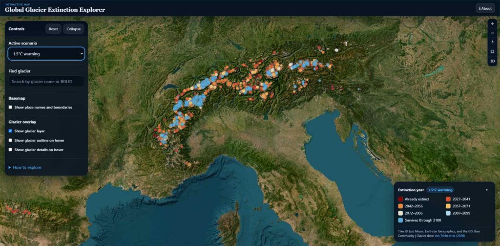
The Alps Among the Areas Changing Most Rapidly
The data most relevant to Europe pertains to the area defined by the study as “Central Europe,” which includes the Alps. Here, more than half of the glaciers are set to disappear over the next two decades. The peak in glacier loss is generally expected before or around 2040 and, unlike in other regions, varies little depending on the warming scenario.
With a temperature increase of +4 degrees, by 2100, only about 20 glaciers would remain in Central Europe, representing a 99% reduction from current levels. With a temperature increase of +2.7 degrees—the scenario associated with current global climate commitments—about 20% of the initial number of glaciers would survive. With a temperature increase of +1.5 degrees, however, nearly half could remain by the end of the century.
Up to 4,000 disappear in a year
The phenomenon is already measurable. According to simulations, approximately 750–800 glaciers are disappearing worldwide each year. The maximum rate would reach about 2,000 annual losses in the +1.5-degree scenario, around 2041, and about 4,000 in the +4-degree scenario, with the peak shifting to the mid-1950s.
These figures are particularly interesting for understanding the pace of change. The glaciers that are disappearing first are largely the smaller ones.
What does “missing” mean?
In the study, a glacier is considered extinct when its surface area falls below 0.01 km² or when its remaining volume is less than 1% of its original volume. This does not necessarily mean that every trace of ice has disappeared at that precise moment; rather, it is a threshold used by models to make thousands of different cases comparable.
Furthermore, the retreat does not normally occur in a single year. A period with little winter snowfall and rapid summer melting can accelerate the final phase. This is what can happen after years of retreat, when the glacier has already lost most of its mass. For this reason, some glaciers marked on the map as nearing extinction are already going through this phase.
“Every fraction of a degree counts,” Van Tricht explained when presenting the project. The difference between the scenarios, in fact, concerns not only the final number of glaciers still remaining in 2100, but also the rate at which their disappearance will occur over the coming decades. The map makes this process visible on the ground: rather than providing data for an entire region, it shows what could happen to a single glacier and over what time frame.