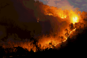
As of July 22, 2026, Italy had already recorded more than 36,600 hectares destroyed by fire: an area equivalent to 50,000 soccer fields, 80% higher than the average over the past twenty years. This is confirmed by satellite data from the European EFFIS (Copernicus) system, which paints a picture of what has now become a structural emergency. This warning follows a dramatic year: according to reports from the European Commission’s Joint Research Center (JRC), 2025 set an all-time record for the continent, with over one million hectares burned in a single season. It is against this backdrop that two digital tools are being launched, designed for those who manage natural areas and must decide—often with limited resources—where to intervene before a fire becomes uncontrollable.
They’re called XN Atlas and FireSight and come from XNatura, the technology division of 3Bee, an Italian company active in nature tech and biodiversity conservation. The launch coincides with the United Nations World Habitat Day on October 5, but their practical applications extend throughout the year.
A Digital Health Check for Every Protected Area
XN Atlas functions like a health report for a specific territory. Every area within the Natura 2000 network—the European network of protected areas for the conservation of habitats and species—can be analyzed free of charge by its managing authority: a public agency, a municipality, or a regional park. The tool provides an overview of the state of local biodiversity and the pressures placing it under stress—from agricultural expansion and road infrastructure to the effects of global warming.
The analysis provides a detailed look at the invasive plant species present in the area and, for birds, supplements the data with field surveys. In addition, it includes microclimatic projections through 2050 and an assessment of fire and flood risks. The platform also allows for the digitization of data collected by field operators, without the need to install sensors or incur consulting costs—all that’s needed is an internet connection.
Simulating a Fire Before It Starts
FireSight, on the other hand, operates in real time. By selecting a point on the map, the system calculates within seconds how a fire might spread over the next 24 hours, cross-referencing data on wind, vegetation type, and terrain. This simulation is designed to guide the decisions of those responsible for organizing fire prevention efforts or coordinating emergency response—including civil protection agencies, municipalities, and park authorities—by identifying in advance which areas are most at risk.
Niccolò Calandri, CEO of 3Bee and XNatura, describes the goal of the initiative as follows: “For too long, monitoring an area and predicting threats has been a privilege reserved for those who could afford expensive sensors and consulting services. With XN Atlas and FireSight, we want to turn this model on its head: to put advanced, easy-to-use scientific tools in the hands of those who care for nature every day.”
The goal is to make data accessible to organizations with limited budgets—which are often the most vulnerable to fire risk in inland and mountainous areas—data that until now required technical expertise and investments that were beyond their reach. Whether this translates into a real reduction in the number of hectares burned will become clear in the coming summers.