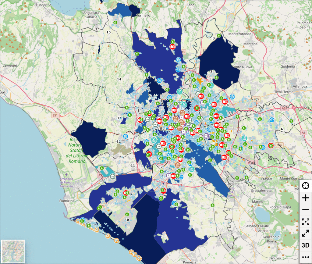
A new map of Rome shows where the heat is most intense and where it’s still possible to find shade, water, and a few degrees of relief. It is from this geography—which is playing an increasingly decisive role in citizens’ daily lives—that Rome’s first Heat Plan takes shape, a strategy that addresses urban heat island effects as an issue of public health, urban planning, and the quality of urban spaces.
The numbers explain why this issue can no longer be considered a seasonal emergency. In 2024, the city’s average temperature reached 19.7 degrees, 2.5 degrees above the climate average for the 1991–2020 period. In 2025, there were 103 days with temperatures above 30 degrees, 41 days above 35 degrees, and 101 tropical nights, while days with freezing temperatures have now disappeared. In the most densely built-up neighborhoods, the “heat island” effect keeps temperatures high even at night, exacerbating health risks and reducing the livability of public spaces.
A widespread network of cool places
The Plan aims to build a citywide network of climate shelters—public spaces where people can spend the hottest hours of the day in greater comfort. The map includes a total of 676 locations, including outdoor areas and air-conditioned buildings, as well as drinking fountains and water stations. Through the dedicated platform, you can locate the nearest shelter and check its hours of operation, accessibility, and available services.
The network includes parks, libraries, museums, senior centers, municipal swimming pools, courtyards, and other public spaces located throughout the neighborhoods. The goal is to provide a place to cool off on the hottest days and to build urban infrastructure capable of reducing the effects of heat on the most vulnerable people.
From Emergency to Urban Transformation
In addition to services for the elderly, the homeless, and the most vulnerable residents, the Plan identifies a series of permanent measures: removing pavement from streets and squares, increasing the number of trees, creating new shaded areas, monitoring climate conditions, and revitalizing public spaces. According to Roma Capitale, in some areas that are completely paved, the combination of trees, permeable surfaces, and shading systems can reduce the perceived temperature by as much as ten degrees.
The RESPIRO project, coordinated by Sapienza University, also fits into this framework. It aims to inventory and enhance existing climate refuges and identify potential ones: squares, courtyards, and public areas that, with relatively modest interventions—new trees, permeable surfaces, shade structures, and street furniture—could become places of relief during heat waves. The initiative, developed in collaboration with the 8th Municipal District and Legambiente, aims to transform public space into a widespread and accessible environmental infrastructure.
After all, the challenge now concerns the very functioning of the city. The heat affects public health, increases energy demand, puts pressure on infrastructure and services, and hits neighborhoods hardest where green spaces are scarce and social vulnerability is highest. For this reason, the Heat Plan proposes to gradually adapt Rome to a climate that, according to scientific evidence, has already changed.